
Archives: Services

Service Overview

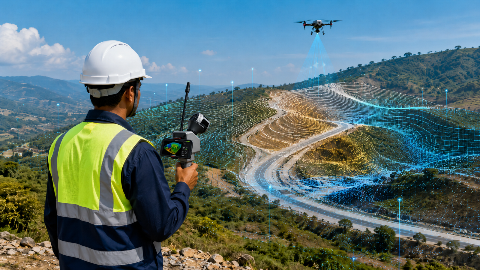
Lemurian Survey Solutions provides advanced SLAM LiDAR, drone survey and 3D mapping services for industrial plants, mining sites, highways, railways, utilities, renewable energy projects and infrastructure development. We help clients capture accurate site data, create 3D point clouds, prepare topographic maps and support planning, design, inspection and project execution.  

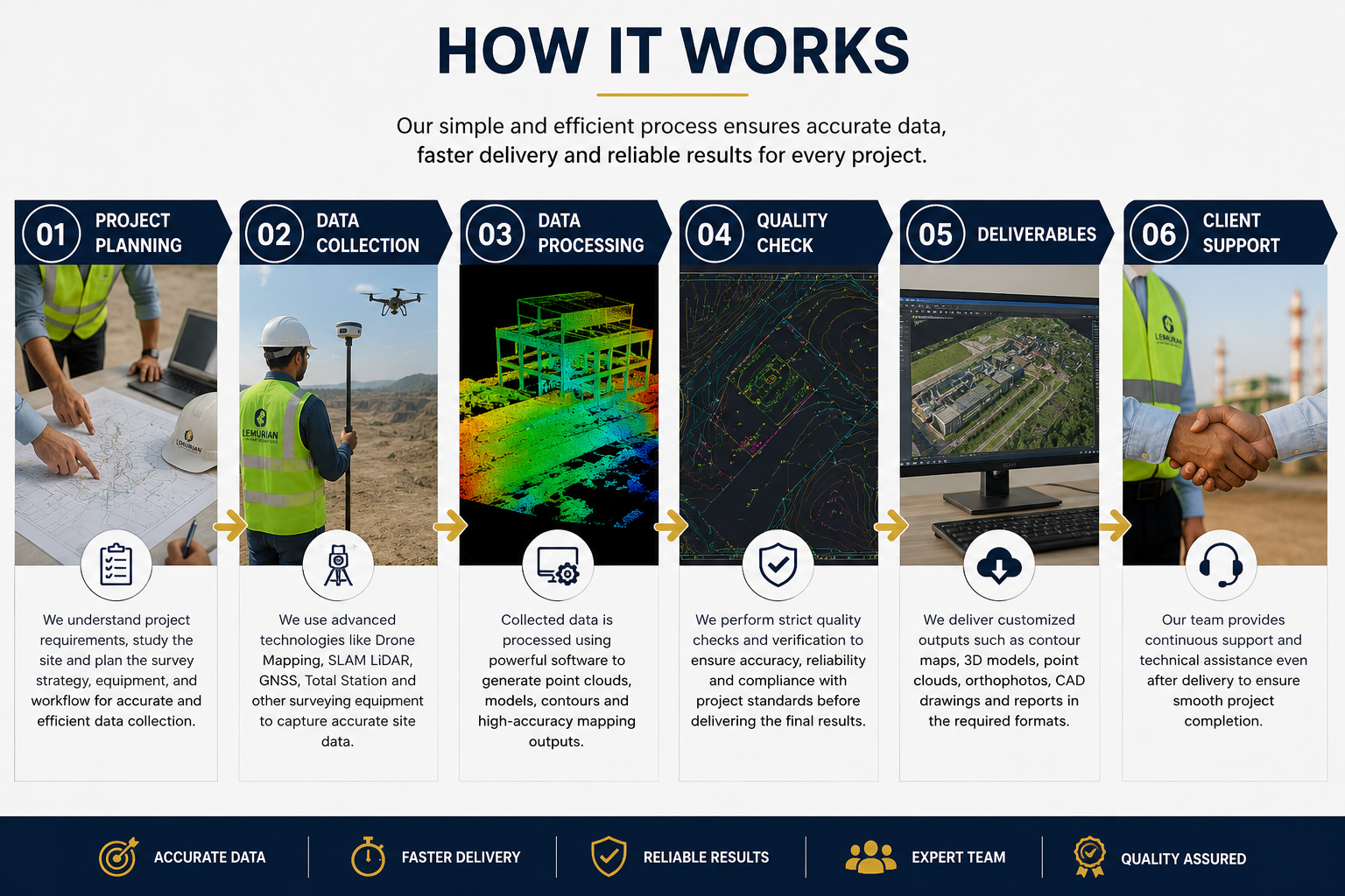
Project Planning

We study the project area, site condition, accuracy requirement, survey method and final deliverables before starting the work. Based on the project needs, we plan the right workflow using SLAM LiDAR, drone mapping, vehicle-mounted LiDAR, GPS/GNSS and GIS processing tools.

Satisfied Service

We focus on delivering accurate, clean and useful survey outputs as per client requirements. Our deliverables may include 3D point cloud data, orthophoto maps, contour maps, DEM, topographic drawings, GIS data, digital twin inputs and professional survey reports.

Dedicated Team

Our experienced team uses modern LiDAR, drone and mapping technologies to complete survey work faster, safer and more accurately. From field data collection to final output preparation, Lemurian Survey Solutions provides reliable support for industrial, infrastructure and government projects.

Benefits of Service

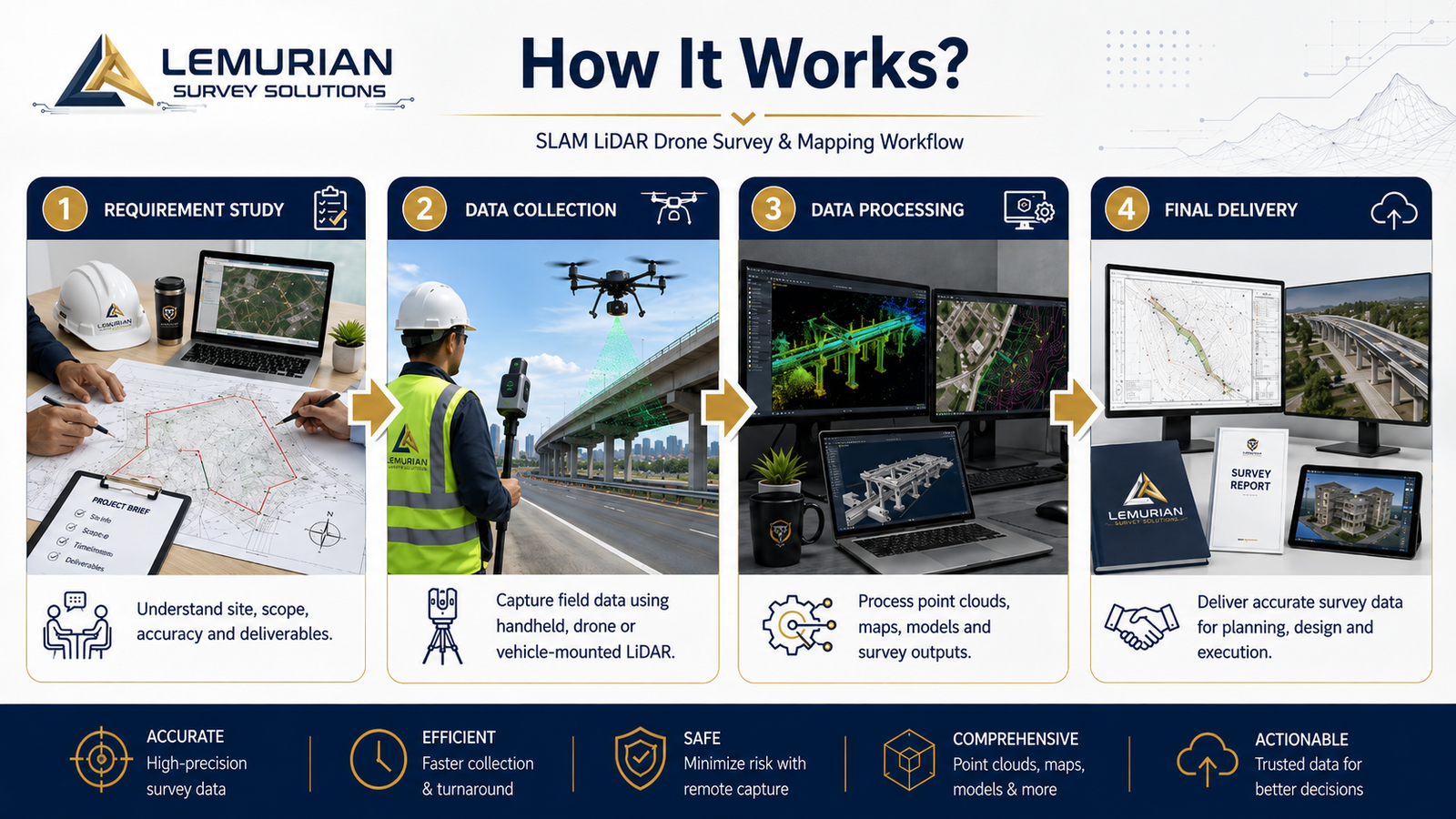
SLAM LiDAR Drone Survey & Mapping is an advanced survey method used to capture accurate 3D site data, point cloud data, terrain details and mapping outputs using SLAM LiDAR, drones and mapping software.

We can support industrial plants, mining sites, highways, railways, construction sites, power utilities, solar plants, wind energy projects, smart city projects and infrastructure development works.

Based on the project scope, we can provide 3D point cloud data, orthophoto maps, contour maps, digital elevation model, topographic drawings, GIS data, digital twin inputs and survey reports.

SLAM LiDAR and drone survey reduce field time, improve safety, capture large areas quickly and provide accurate digital data for planning, design, inspection, construction and project monitoring.

How It Works?
Service Overview

Lemurian Survey Solutions provides Digital Twin and Scan-to-BIM services by converting real site conditions into accurate 3D models, point cloud data and BIM-ready outputs for planning, design, maintenance and facility management. 

Project Planning

We understand the project area, required model detail, accuracy level, output format and client requirement before starting the scan. This helps us plan the right SLAM LiDAR scanning and BIM workflow.

Satisfied Service

We deliver clean and reliable outputs such as 3D point cloud data, BIM models, as-built documentation, digital twin data, drawings and inspection-ready reports based on project needs.

Dedicated Team

Our team uses SLAM LiDAR, 3D scanning, point cloud processing and BIM tools to create accurate digital models for factories, industrial plants, buildings, utilities and infrastructure projects.

Benefits of Service

Digital Twin and Scan-to-BIM is the process of capturing real site conditions using SLAM LiDAR or 3D scanning and converting the data into accurate 3D models, BIM files and digital documentation.

We can scan industrial plants, factories, buildings, warehouses, utilities, mechanical areas, infrastructure sites, renovation projects and existing facilities.

Based on the project scope, we can provide 3D point cloud data, as-built BIM models, Revit-ready models, CAD drawings, floor plans, elevation drawings, digital twin data and inspection reports.

Scan-to-BIM helps improve planning, design coordination, renovation work, clash checking, facility management and maintenance by providing accurate digital records of existing site conditions.

How It Works?

Service Overview

Lemurian Survey Solutions provides accurate topographic survey and mapping services using advanced drone mapping, SLAM LiDAR, GNSS and surveying technologies. We capture detailed ground features, elevations, contours, roads, utilities, buildings, drainage lines and site conditions to support engineering design, construction planning and infrastructure development

Project Planning

Before starting the survey, our team studies the project location, client requirements, required accuracy, site accessibility and final deliverables. We plan the survey workflow carefully to ensure fast data collection, proper coverage, safety on site and reliable mapping outputs for design and execution teams.

Satisfied Service

Every topographic survey is processed with professional quality checks to ensure accurate measurements, clean drawings and reliable terrain data. Our deliverables can include contour maps, DEM, DSM, orthophoto maps, 2D CAD drawings, 3D point clouds and detailed site mapping based on project requirements.

Dedicated Team

Our experienced survey engineers, drone pilots, LiDAR operators and CAD/GIS specialists work together to deliver precise topographic data. From field data capture to final drawing preparation, our team ensures smooth coordination, accuracy and timely project completion.

Benefits of Service

There are many variations of passages of Lorem Ipsum available, but the majority have suffered alteration.

Topographic survey helps you understand the complete site condition, including ground levels, contours, roads, buildings, drains, utilities, trees and existing structures. This data supports accurate planning, design, estimation and construction execution.

We use advanced survey technologies such as Drone Mapping, SLAM LiDAR, GNSS/DGPS, Total Station, 3D Point Cloud Processing, CAD and GIS software based on the project requirement and accuracy needs.

We can provide contour maps, topographic drawings, orthophoto maps, DEM/DSM, 3D point clouds, CAD drawings, elevation data, site layout maps and GIS-ready outputs as per the client’s project scope.

This service is useful for highways, railways, industrial plants, mining, construction, real estate, solar farms, government planning, smart city projects and infrastructure development.

How It Works?

Service Overview

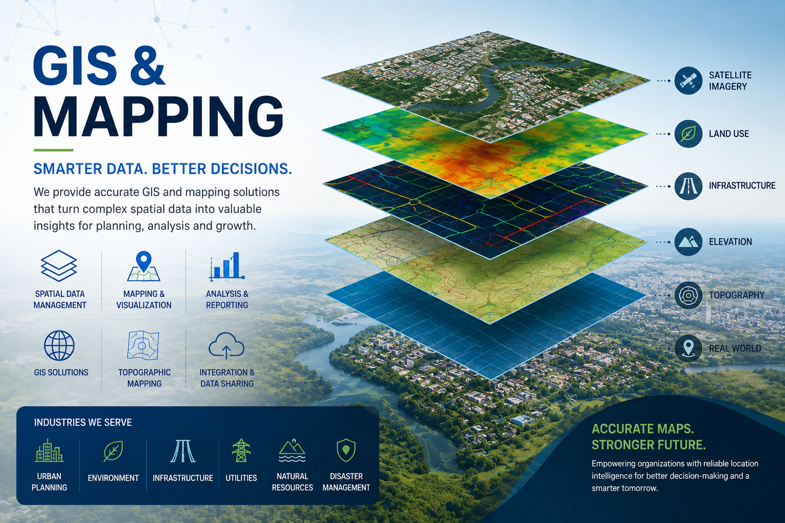
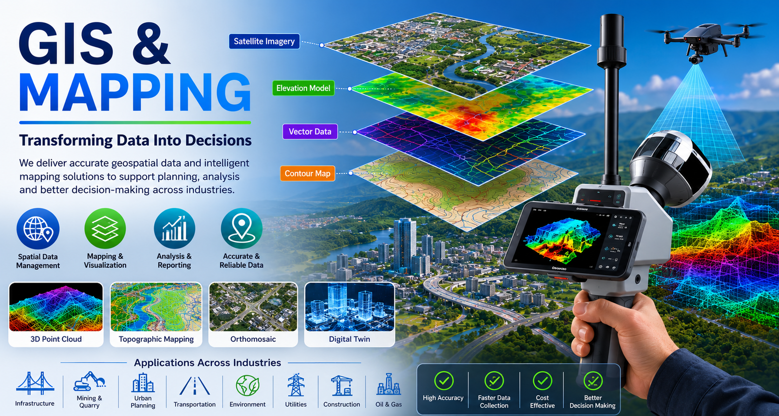
Lemurian Survey Solutions provides professional GIS and mapping services for accurate spatial data, topographic mapping, asset mapping, infrastructure planning and project decision-making.

Project Planning

We understand the project area, mapping requirement, accuracy level and required output format before starting the work. This helps us plan the right survey and GIS workflow.

Satisfied Service

We deliver clean, accurate and usable GIS outputs such as maps, spatial data, contours, orthomosaic maps, CAD/GIS files and reports based on client requirements.

Dedicated Team

Dedicated Team & Plan With a long and given to environment slightly design planning.

Benefits of Service

We provide GIS data creation, topographic mapping, orthomosaic mapping, contour mapping, asset mapping, utility corridor mapping, land use mapping and CAD/GIS-ready outputs.

We can use drone survey data, SLAM LiDAR point cloud data, GPS/GNSS data, field survey data, satellite imagery and existing CAD drawings to prepare accurate GIS maps.

Based on the project scope, we can provide GIS maps, orthomosaic maps, contour maps, digital elevation models, asset mapping data, spatial databases, CAD files, GIS files and survey reports.

GIS mapping helps you understand project areas clearly, manage spatial data, plan infrastructure, monitor assets, identify site conditions and make better decisions with accurate digital maps.

How It Works?

Service Overview

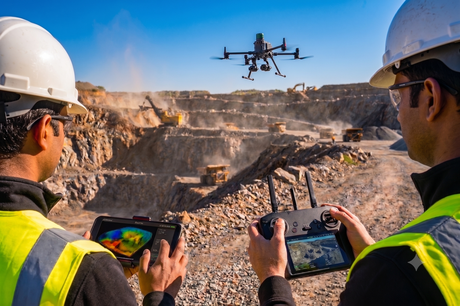
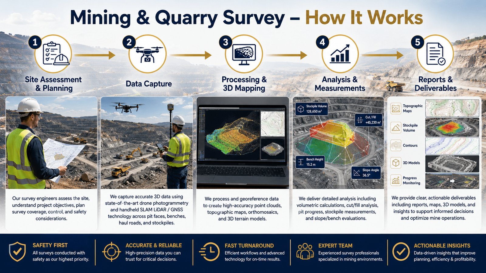
Lemurian Survey Solutions provides professional Mining & Quarry Survey services using advanced Drone Mapping, SLAM LiDAR, GNSS and 3D mapping technologies. We help mining and quarry operators capture accurate terrain data, stockpile volumes, pit conditions, haul roads, benches, slopes and site layouts for better planning, monitoring and operational control.

Project Planning

Before starting the survey, our team studies the mining site, quarry layout, safety conditions, access routes, required accuracy and client deliverables. Based on the project requirement, we plan the drone flight, SLAM LiDAR scanning route, ground control points and data collection workflow to ensure complete site coverage and reliable results.

Quality-Assured Service

Every survey output is processed with proper quality checks to ensure accurate measurements and dependable mapping data. We validate point clouds, orthophotos, contours, elevation models and volume calculations before delivering the final results to the client.

Dedicated Team

Our experienced drone pilots, LiDAR operators, survey engineers and CAD/GIS specialists work together to deliver accurate mining and quarry survey outputs. From field data capture to final report preparation, our team ensures safety, accuracy and timely project completion.

Benefits of Service

Mining and quarry survey helps you understand the complete site condition, including pit levels, stockpile quantity, haul roads, benches, slopes and excavation areas. This supports better planning, production monitoring and decision-making.

Yes. We provide accurate stockpile volume calculation using drone mapping, LiDAR point cloud data and advanced processing software. This helps clients track material quantity, production and inventory.

Yes. We provide accurate stockpile volume calculation using drone mapping, LiDAR point cloud data and advanced processing software. This helps clients track material quantity, production and inventory.

We can provide orthophoto maps, contour maps, DEM/DSM, 3D point clouds, stockpile volume reports, quarry layout maps, cross-sections, CAD drawings and GIS-ready outputs based on your requirement.

How It Works?

Service Overview

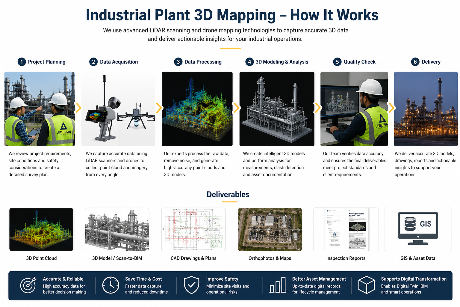
Lemurian Survey Solutions provides advanced Industrial Plant 3D Mapping using SLAM LiDAR, drone survey, terrestrial laser scanning and GIS-based mapping workflows. We capture accurate 3D point cloud data of factories, process plants, pipelines, machinery areas, utility corridors, storage yards and structural assets.Our mapping solutions help industries with Digital Twin creation, Scan-to-BIM, as-built documentation, asset inspection, maintenance planning, plant expansion, safety analysis and engineering design support.

Project Planning

Detailed site planning, safety coordination, scanning route preparation and survey workflow setup for accurate industrial plant mapping.

Satisfied Service

Reliable 3D point cloud, CAD/BIM-ready data, inspection support and professional reporting for industrial clients.

Dedicated Team

Experienced Drone, LiDAR and GIS team for industrial plant survey, asset mapping and digital documentation works.

Benefits of Service

Industrial Plant 3D Mapping helps to document existing plant conditions accurately for maintenance, modification, expansion, safety review and engineering design.

We provide 3D point cloud data, CAD drawings, Scan-to-BIM models, asset layout maps, inspection reports, orthophotos and GIS-based deliverables based on project requirements.

Yes. We can perform non-contact scanning and drone-based mapping with proper safety coordination, reducing disturbance to plant operations

Chemical plants, manufacturing units, power plants, refineries, process industries, warehouses, utility plants, mining facilities and infrastructure projects can use this service.

How It Works?

Service Overview

Lemurian Survey Solutions provides advanced highway and infrastructure survey services using SLAM LiDAR, drone mapping and vehicle-mounted LiDAR technology. We help clients capture accurate road corridor data, bridge details, terrain information, utilities, structures and site conditions for planning, design, construction and expansion projects.Our survey solutions support highway widening, new road projects, bridge and flyover survey, railway/metro corridors, drainage planning, utility mapping and infrastructure development.

Project Planning

Our survey solutions support highway widening, new road projects, bridge and flyover survey, railway/metro corridors, drainage planning, utility mapping and infrastructure development.

Satisfied Service

We focus on delivering reliable survey outputs with clear documentation and professional support. Our team provides accurate mapping data, point cloud outputs, contour maps, orthophotos, drawings and reports based on client requirements. Our goal is to help clients complete infrastructure projects faster with better planning, accurate measurements and dependable survey data.

Dedicated Team

Our experienced survey and mapping team works with advanced LiDAR, drone and GIS technologies to support highway and infrastructure projects. We ensure proper field data capture, quality checking, data processing and final output preparation. From site survey to final deliverables, our team supports clients with professional coordination and timely project completion

Benefits of Service

We provide SLAM LiDAR survey, drone mapping, vehicle-mounted LiDAR survey, topographic survey, road corridor mapping, bridge and flyover survey, railway/metro corridor survey, utility mapping and GIS-ready survey outputs.

We use advanced SLAM LiDAR scanners, drones, vehicle-mounted LiDAR systems, GPS/GNSS, mapping software and GIS processing tools based on the project requirement and site condition.

Based on the project scope, we can provide 3D point cloud data, orthophoto maps, contour maps, digital elevation model, topographic drawings, road alignment data, cross-section details, GIS data and survey reports.

LiDAR helps capture accurate 3D data quickly across long corridors, bridges, flyovers, road edges, terrain, utilities and surrounding structures. It reduces field time, improves safety and supports better design and planning.

How It Works?

Service Overview

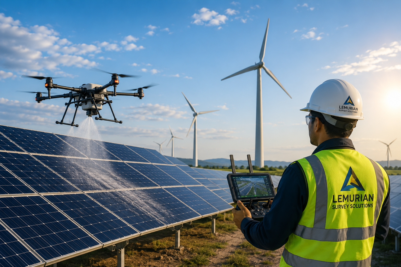
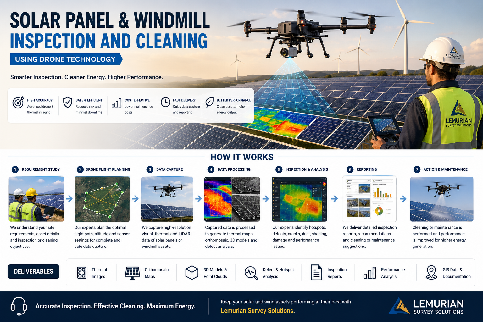
Lemurian Survey Solutions provides professional Solar Panel & Windmill Inspection and Cleaning services using drone technology, thermal imaging, LiDAR-based site mapping, and field inspection methods. We support solar plants, rooftop solar systems, wind farms, EPC companies, O&M teams, and renewable energy asset owners with solar panel cleaning, hotspot detection, thermal inspection, windmill blade inspection, defect identification, performance monitoring, maintenance planning, and professional reporting.

Project Planning

Detailed site study, safety planning, drone flight planning, cleaning schedule preparation, and inspection workflow setup for solar and wind energy assets.

Satisfied Service

Reliable inspection, cleaning support, thermal monitoring, defect reporting, and maintenance recommendations for renewable energy clients.

Dedicated Team

Experienced drone, LiDAR, inspection, and cleaning support team for solar panel farms, rooftop solar sites, and windmill assets.

Benefits of Service

Solar panel cleaning removes dust, bird droppings, stains, and other deposits that reduce energy generation and panel efficiency.

Drone inspection helps identify hotspots, damaged panels, dust accumulation, wiring issues, shadow impact, and performance defects quickly and safely.

Yes. We provide drone-based windmill blade inspection to identify cracks, erosion, lightning damage, surface defects, and maintenance requirements.

We provide inspection reports, thermal images, defect location mapping, cleaning recommendations, maintenance reports, drone visuals, and GIS/LiDAR-based asset documentation if required.

How It Works?

Service Overview

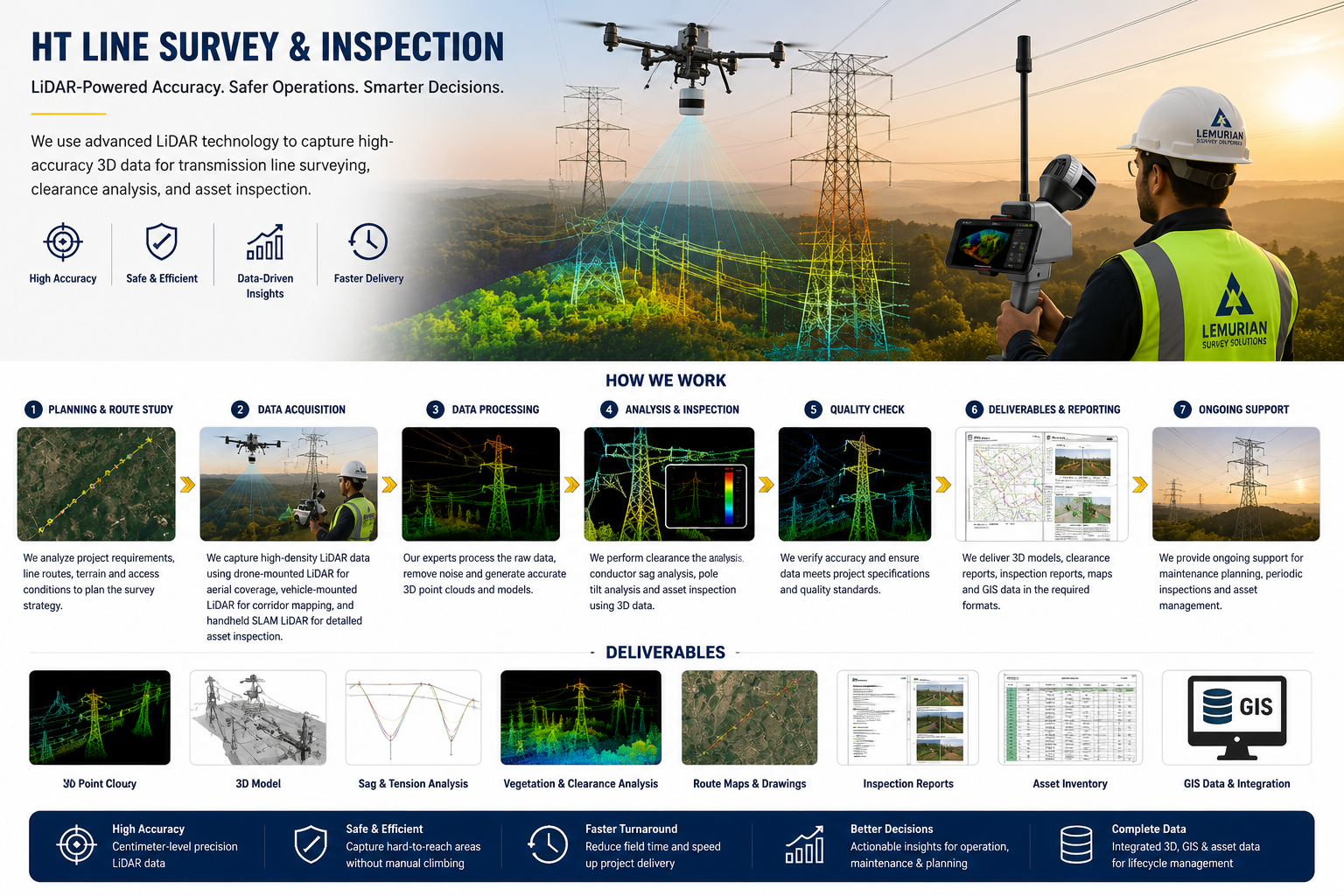
Lemurian Survey Solutions provides advanced HT Line Survey & Inspection using drone-mounted LiDAR, handheld SLAM LiDAR and geospatial mapping technologies. We capture accurate 3D data of transmission lines, towers, corridors, vegetation clearance, sag conditions and surrounding terrain.Our HT line survey supports route mapping, clearance analysis, tower inspection, vegetation management, asset documentation, maintenance planning and GIS-based reporting for power transmission and utility projects.

Project Planning

Detailed route study, safety planning, access review and survey workflow preparation for accurate HT line inspection.

Satisfied Service

Reliable LiDAR data, inspection reports, clearance analysis and GIS-ready deliverables for power transmission clients.

Dedicated Team

Experienced Drone, LiDAR and GIS team for HT line corridor survey, tower inspection and utility asset mapping.

Benefits of Service

HT line survey helps identify tower condition, conductor sag, vegetation clearance, corridor encroachment and maintenance requirements.

We use drone-mounted LiDAR, handheld SLAM LiDAR, aerial imaging, GIS mapping and 3D point cloud processing.

We provide 3D point cloud, route maps, tower inspection reports, vegetation clearance reports, sag analysis, GIS data and asset inventory.

Yes. LiDAR data helps measure clearance between power lines, trees, terrain and nearby structures for safe operation.

How It Works?