
Topographic Survey & Mapping

Service Overview

Lemurian Survey Solutions provides accurate topographic survey and mapping services using advanced drone mapping, SLAM LiDAR, GNSS and surveying technologies. We capture detailed ground features, elevations, contours, roads, utilities, buildings, drainage lines and site conditions to support engineering design, construction planning and infrastructure development

Project Planning

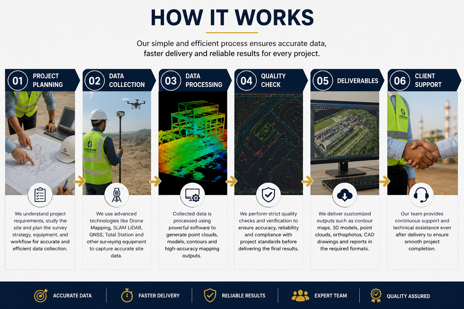
Before starting the survey, our team studies the project location, client requirements, required accuracy, site accessibility and final deliverables. We plan the survey workflow carefully to ensure fast data collection, proper coverage, safety on site and reliable mapping outputs for design and execution teams.

Satisfied Service

Every topographic survey is processed with professional quality checks to ensure accurate measurements, clean drawings and reliable terrain data. Our deliverables can include contour maps, DEM, DSM, orthophoto maps, 2D CAD drawings, 3D point clouds and detailed site mapping based on project requirements.

Dedicated Team

Our experienced survey engineers, drone pilots, LiDAR operators and CAD/GIS specialists work together to deliver precise topographic data. From field data capture to final drawing preparation, our team ensures smooth coordination, accuracy and timely project completion.

Benefits of Service

There are many variations of passages of Lorem Ipsum available, but the majority have suffered alteration.

Topographic survey helps you understand the complete site condition, including ground levels, contours, roads, buildings, drains, utilities, trees and existing structures. This data supports accurate planning, design, estimation and construction execution.

We use advanced survey technologies such as Drone Mapping, SLAM LiDAR, GNSS/DGPS, Total Station, 3D Point Cloud Processing, CAD and GIS software based on the project requirement and accuracy needs.

We can provide contour maps, topographic drawings, orthophoto maps, DEM/DSM, 3D point clouds, CAD drawings, elevation data, site layout maps and GIS-ready outputs as per the client’s project scope.

This service is useful for highways, railways, industrial plants, mining, construction, real estate, solar farms, government planning, smart city projects and infrastructure development.

How It Works?