
Service Overview
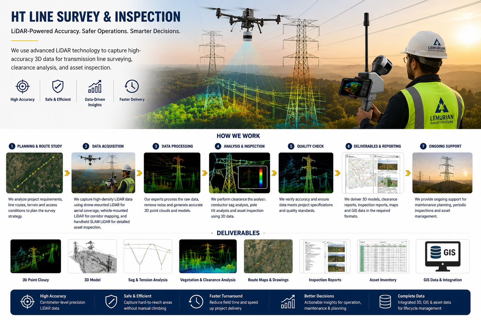
Lemurian Survey Solutions provides advanced HT Line Survey & Inspection using drone-mounted LiDAR, handheld SLAM LiDAR and geospatial mapping technologies. We capture accurate 3D data of transmission lines, towers, corridors, vegetation clearance, sag conditions and surrounding terrain.Our HT line survey supports route mapping, clearance analysis, tower inspection, vegetation management, asset documentation, maintenance planning and GIS-based reporting for power transmission and utility projects.
Project Planning
Detailed route study, safety planning, access review and survey workflow preparation for accurate HT line inspection.
Satisfied Service
Reliable LiDAR data, inspection reports, clearance analysis and GIS-ready deliverables for power transmission clients.
Dedicated Team
Experienced Drone, LiDAR and GIS team for HT line corridor survey, tower inspection and utility asset mapping.
Benefits of Service
HT line survey helps identify tower condition, conductor sag, vegetation clearance, corridor encroachment and maintenance requirements.
We use drone-mounted LiDAR, handheld SLAM LiDAR, aerial imaging, GIS mapping and 3D point cloud processing.
We provide 3D point cloud, route maps, tower inspection reports, vegetation clearance reports, sag analysis, GIS data and asset inventory.
Yes. LiDAR data helps measure clearance between power lines, trees, terrain and nearby structures for safe operation.
How It Works?