
Service Overview
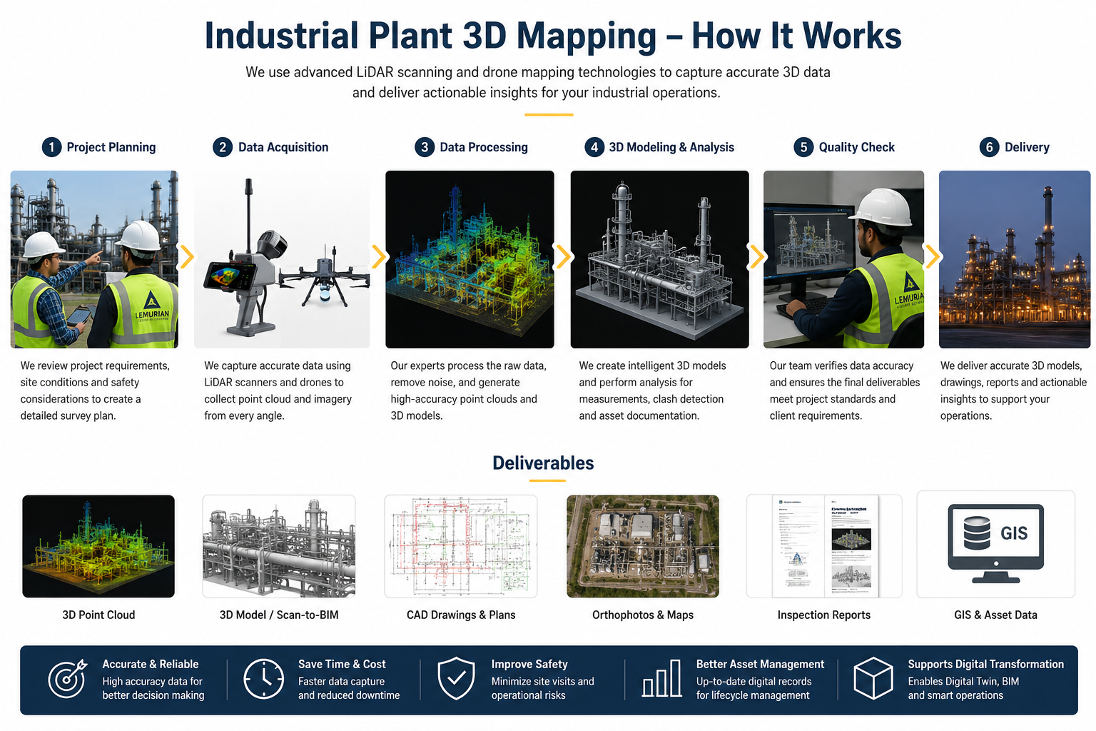
Lemurian Survey Solutions provides advanced Industrial Plant 3D Mapping using SLAM LiDAR, drone survey, terrestrial laser scanning and GIS-based mapping workflows. We capture accurate 3D point cloud data of factories, process plants, pipelines, machinery areas, utility corridors, storage yards and structural assets.Our mapping solutions help industries with Digital Twin creation, Scan-to-BIM, as-built documentation, asset inspection, maintenance planning, plant expansion, safety analysis and engineering design support.
Project Planning
Detailed site planning, safety coordination, scanning route preparation and survey workflow setup for accurate industrial plant mapping.
Satisfied Service
Reliable 3D point cloud, CAD/BIM-ready data, inspection support and professional reporting for industrial clients.
Dedicated Team
Experienced Drone, LiDAR and GIS team for industrial plant survey, asset mapping and digital documentation works.
Benefits of Service
Industrial Plant 3D Mapping helps to document existing plant conditions accurately for maintenance, modification, expansion, safety review and engineering design.
We provide 3D point cloud data, CAD drawings, Scan-to-BIM models, asset layout maps, inspection reports, orthophotos and GIS-based deliverables based on project requirements.
Yes. We can perform non-contact scanning and drone-based mapping with proper safety coordination, reducing disturbance to plant operations
Chemical plants, manufacturing units, power plants, refineries, process industries, warehouses, utility plants, mining facilities and infrastructure projects can use this service.
How It Works?